Big Boulders
A Place to AttachBy Greg Geehan, John F. Williams
Photos & video by John F. Williams except where noted

Big Boulders
A Place to Attach
By Greg Geehan, John F. Williams, Autumn 2018
Photos & video by John F. Williams except where noted
Much of the sand and gravel on Salish Sea beaches comes from the erosion of nearby bluffs caused by the combined attack of heavy rains from above and storm waves at their base. Tools like Google Earth make it fairly easy to see just how widespread bluffs are around the Salish Sea.
Audio version
Foulweather Bluff, near Hansville, WA

Foulweather Bluff, near Hansville, WA
map courtesy of Washington state Department of Natural Resources
why are those bluffs there?
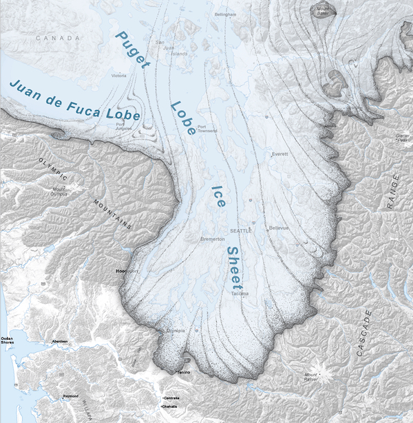
Glaciers covered the Salish Sea region many times over the last million years. They came from the North and brought with them loads of rocks and sediment eroded from coastal mountains. Imagine a huge glacier thousands of feet thick slowly grinding its way into our region, carrying all sorts and sizes of stuff it picked up along the way. Each glacier that came and went left deposits of every grain size from clay up to boulders. Between glacial periods, rivers flowed down into the Salish lowlands carrying more sediment. The resulting layers are hundreds or even thousands of feet thick.

Flowing water sorts sediment into equal grain size layers. The laminated sand deposit in this photo may have been left by a river coming from nearby mountains or perhaps melt-water from an advancing glacier. But the last thing a glacier leaves behind is not affected by flowing water. It is an unsorted mix of every grain size, from clay and silt up to large boulders. This is called ‘glacial till’ and in many places it is the first thing we encounter just below the soil.
After the troughs scoured by the glaciers filled with water, waves eroded the landscape where they came ashore, turning slopes into bluffs.
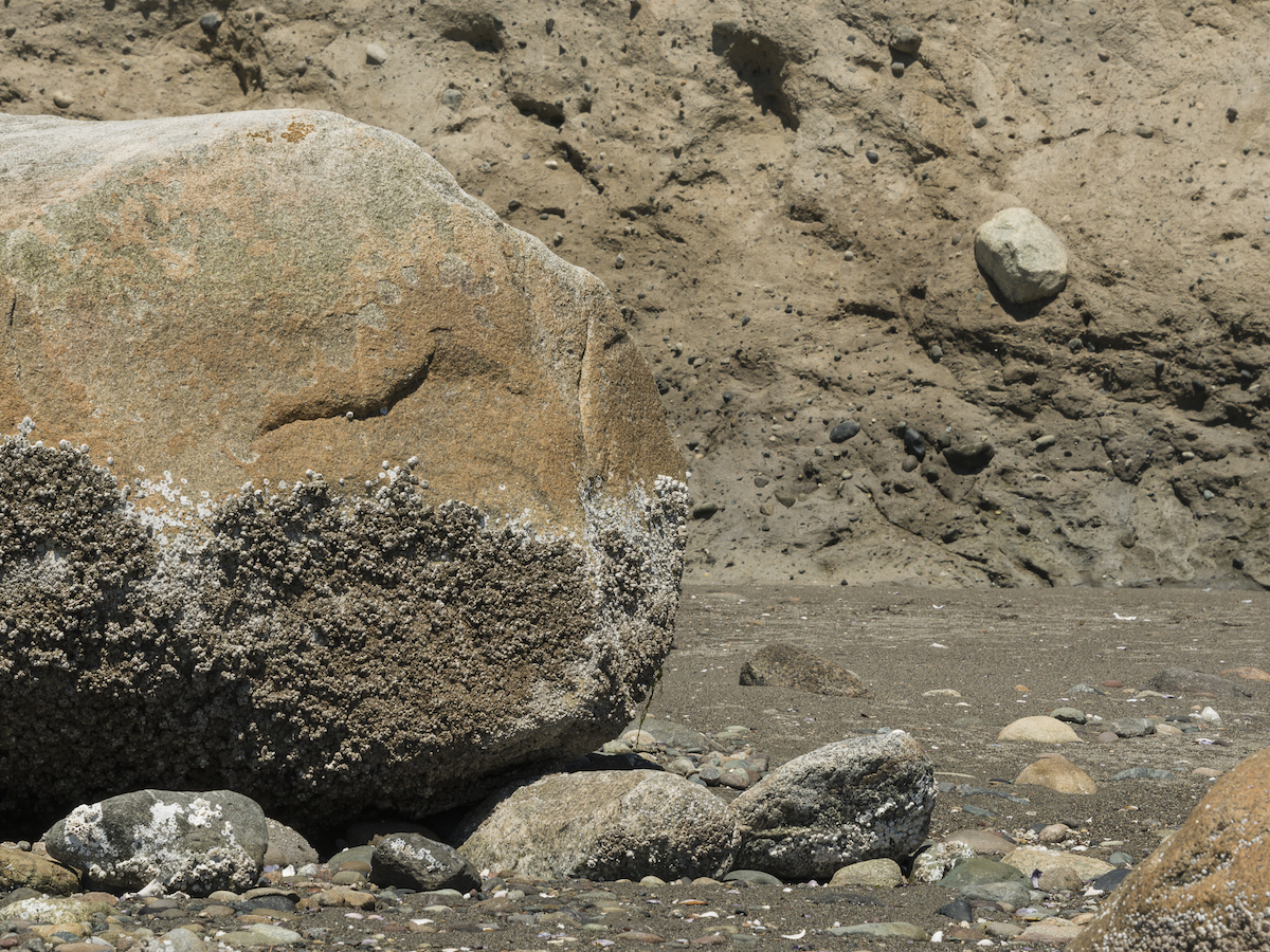
And because there were sometimes boulders in the sand and gravel deposited by the glaciers, we see the occasional huge boulder towering over the beach, left there after the bluff eroded.
Many of the large rocks we see were brought here by glaciers, and left when the glaciers melted. This is an excerpt from the movie The Geological Formation of Bainbridge Island. See citation in “Find Out More” below.
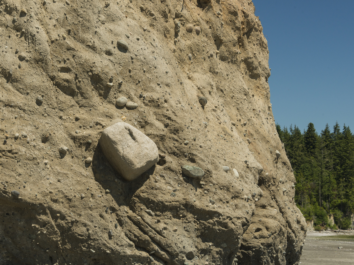
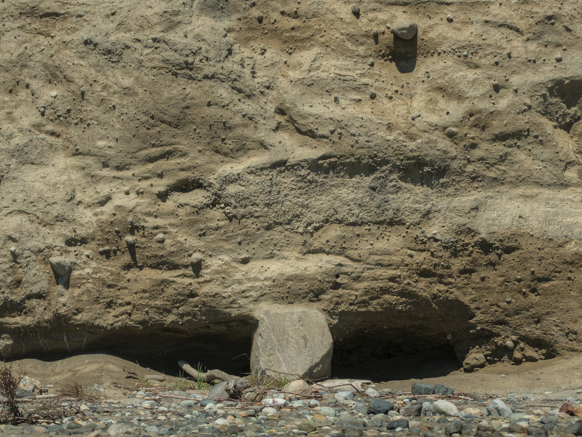
But sometimes we can also see large rocks still embedded in a bluff, waiting to be set free on the beach.
Rock in Bluff
Rock in Bluff closeup
Rock at foot of bluff
Rock in Bluff
Rock in Bluff closeup
Rock at foot of bluff
a place to live
Let’s take a look at one important role of these large boulders on the beach: a place for marine life to attach. Other articles in this issue describe some of the marine creatures like mussels, barnacles and anemones that attach to stable, hard surfaces like boulders. Their strategy is to live in one place and allow the currents to bring them the plankton that they feed on. There is also an article about sea stars that are often found on these hard surfaces preying on the attached life.
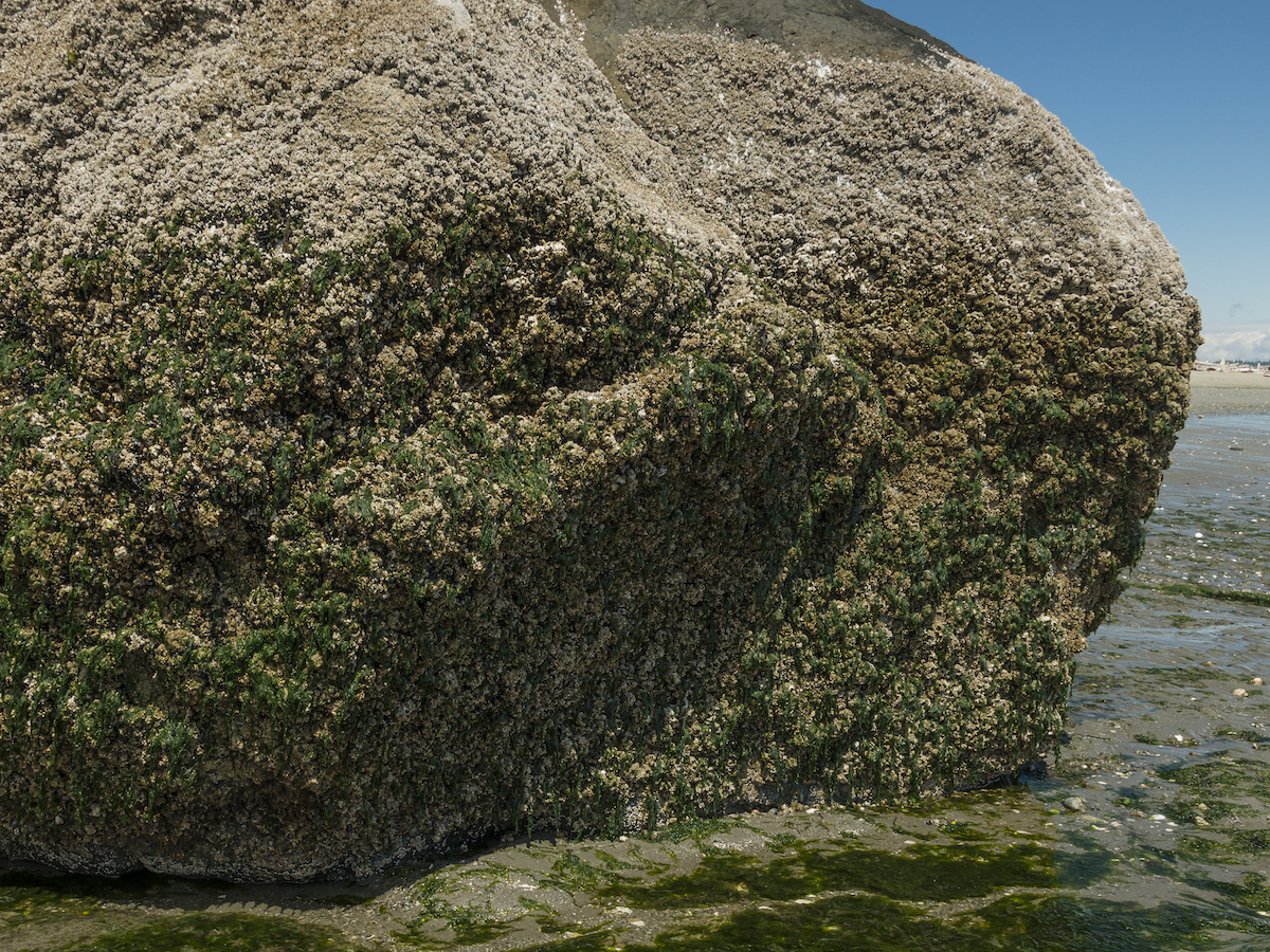
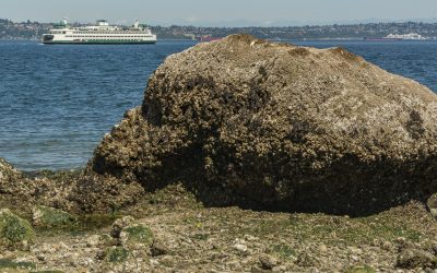
One of the interesting things about giant rocks on the beach is that one can see the high tide line by the growth on the hard surface.
As a matter of fact, if the boulder is large enough and low enough in the intertidal zone, one can see horizontal layers of life. The most resilient creatures, those that can tolerate the most time out of the water, will be near the top. The mix of creatures at the bottom will include those that are less tolerant of being dry. The Salish Sea has quite a large tidal swing, so if the boulder is large enough, this “graph” of tide-tolerant creatures can be more than 10 feet tall in some locations.

Layers of Life on Glacial Erratic
This large glacial erratic is found on the beach south of the lighthouse at Point No Point, Washington
Close-up of glacial erratic
The creatures near the upper parts of this glacial erratic that are exposed longer are a different mix from those near the bottom.
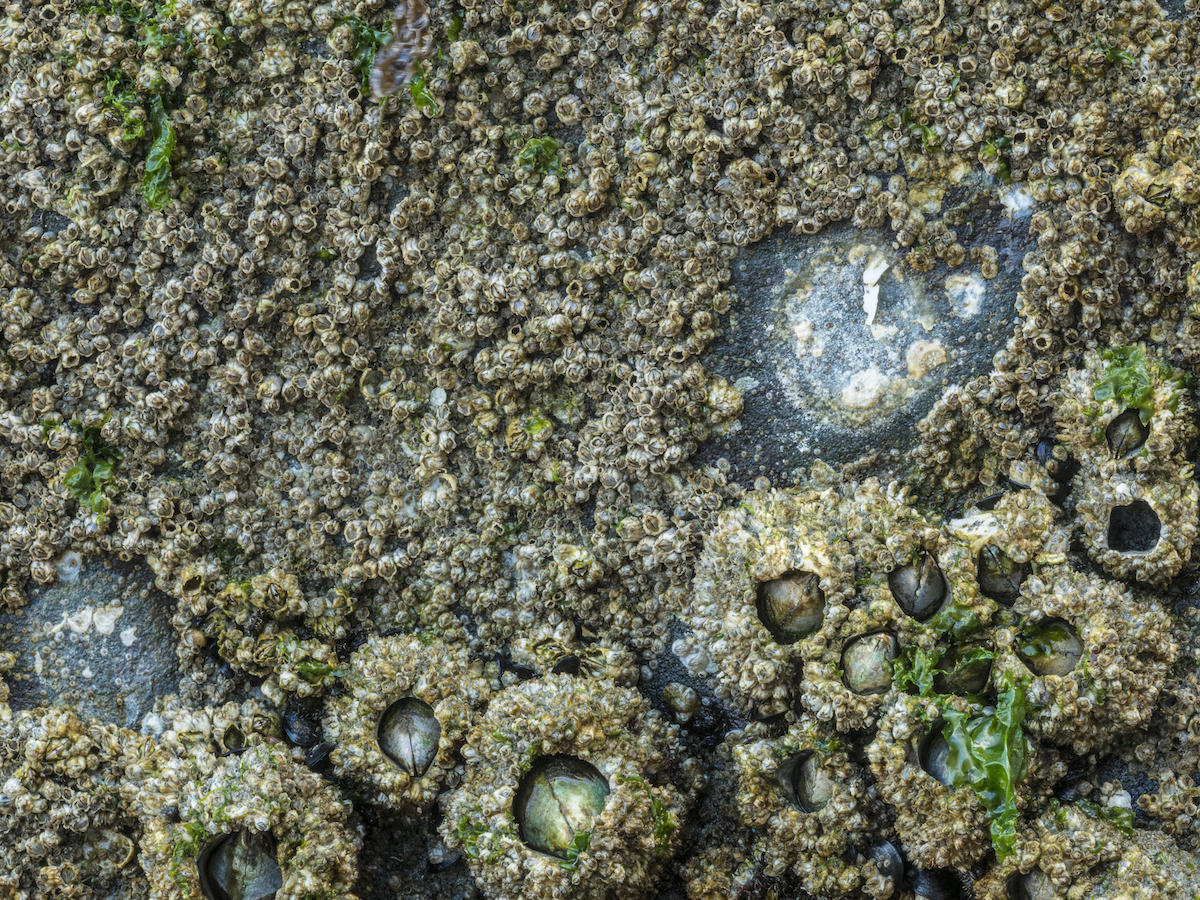
Barnacles on boulder
Near the top are mainly small barnacles, with larger ones joining in below that.
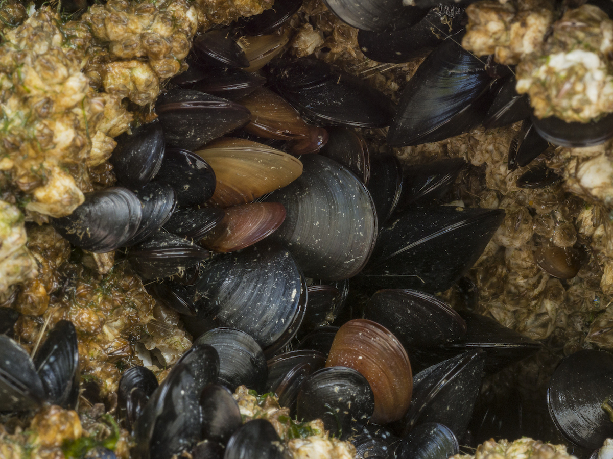
Mussels on boulder
Lower down, mussels join the larger barnacles
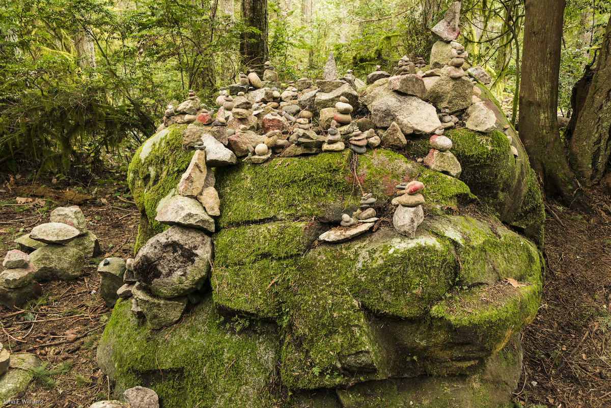
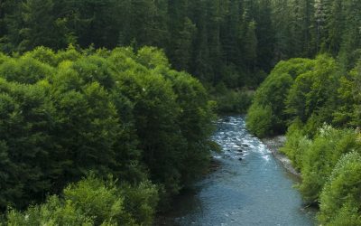
Sometimes large boulders can be seen in our forests, and they don’t look like they eroded out of a nearby bluff. How did they get there? You will see more about our forests in future issues of Salish Magazine.

photo courtesy of the Suquamish Museum
cultural modifications
Some boulders have been decorated over the ages. For example, the boulder shown above is called “Haleets”. It is inscribed with petroglyphs and is on a beach at Agate Point on Bainbridge Island. Estimates of the age of the carvings range from 1,500 to 3,000 years ago. The meaning of the markings is not known, but some think that it served as a landmark explaining to outsiders the implications of entering the region. Another example of human decoration is the famous “Frog Rock” on Bainbridge Island shown on this article’s first page. Another interesting cultural use of large boulders is as living community art projects. I’ve seen several boulders with ever-changing decorations deposited by passers-by.
So next time you see a large boulder on the beach, take a closer look. The top rows of barnacles show about how high the tide gets. If there are tide pools around the boulder, maybe you can see barnacles in action, or anemones that are open with their tentacles stretching out into the water. You might even see a mussel open, sucking water in one siphon and expelling it out the other. And if you see all of those things, chances are good that there are sea stars nearby.

Greg Geehan grew up in Tacoma, graduated from the University of Washington, and earned a PhD in Marine Geology at Scripps Institution of Oceanography. He then worked in the oil industry for over 20 years in a career that took him to Houston, San Francisco, Alaska, London, Kuwait, and Colombia. Upon retirement, Greg and his wife Kathy returned to the Puget Sound area and chose to live on Bainbridge Island partly because of its reputation for supporting education and environmental conservation. Greg is a docent at IslandWood, a member of the Bainbridge Island Kiwanis club, and a board member of the Bainbridge Island Land Trust. He is co-author and narrator of the video Geological Formation of Bainbridge Island, produced and directed by Cameron Snow.
Other Articles in This Issue
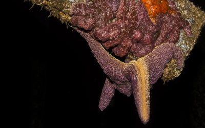
Seeing Stars?
By Jeanne Wright, Nancy Sefton Photos & video by John F. Williams except where notedA Struggling Keystone Species By Jeanne Wright, Nancy Sefton, Autumn 2018 Photos & video by John F. Williams except where notedcommon in the salish sea Several kinds of...
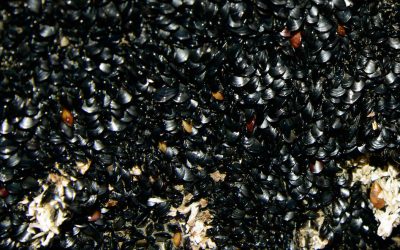
Mussel Strength
How Mussels Serve Our Ecosystem By Jill Needham, Kathleen Alcalá Photos & video by John F. Williams except where notedHow Mussels Serve Our Ecosystem By Jill Needham, Kathleen Alcalá, Autumn 2018 Photos & video by John F. Williams except where notedcommon in...
The Barnacle
By Tasha Smith, Leigh Calvez, Deb Rudnick Photos & video by John F. Williams except where notedMore Than Meets the Eye By Tasha Smith, Leigh Calvez, Deb Rudnick, Autumn 2018 Photos & video by John F. Williams except where notedMy first experience with...
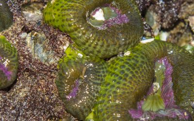
Flower of the Tide Pool
By Briana Sandoval Sharon Pegany Photos & video by John F. Williams except where notedPlant or Animal? By Paul Pegany, Summer 2019 Photos & video by John F. Williams except where noted Aggregating anemones are commonly found at low tide around the Salish...
Postscript-1
By John F. Williams Photos & video by John F. Williams except where notedVisualizing an Ecosystem By John F. Williams Photos & video by John F. Williams except where notedTelling the story of a system as complex as the ecosystem we live in is a tall order....
FIND OUT MORE
Snow Productions, BI: The Geological Formation of Bainbridge Island, Narrator, Gregory Geehan.
Glacier map and additional information about Puget Sound and Coastal Geology: https://www.dnr.wa.gov/programs-and-services/geology/explore-popular-geology/puget-sound-and-coastal-geology#puget-sound-geology
Haleets in Wikipedia: https://en.wikipedia.org/wiki/Haleets