Records of Earthquakes and Tsunamis in Coastal Wetlands
by Carrie Garrison-Laney and Ian Miller
Autumn 2020
A photo of sediments in the coastal marsh near the mouth of Salt Creek on the Strait of Juan de Fuca, showing distinct bands of different colors and textures. Photo by Ian Miller.

A photo of sediments in the coastal marsh near the mouth of Salt Creek on the Strait of Juan de Fuca, showing distinct bands of different colors and textures. Photo by Ian Miller.
Records of Earthquakes and Tsunamis in Coastal Wetlands
by Carrie Garrison-Laney and Ian Miller, Summer 2020
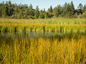
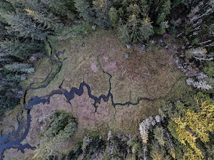
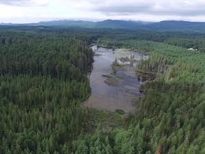
The peaceful hiking trails of the Theler Wetlands at the head of Hood Canal are alive with marsh grasses, blue heron, and bald eagles. In the fall, salmon wash up in the marsh after spawning. The peace and tranquility of this popular preserve and walking trails belie their history of strong shaking, sudden land-level change, and tsunamis that have rocked the marsh in the past. The coastal wetlands of the Salish Sea are rich, diverse habitats, and they are an important focus of coastal ecosystem restoration efforts in our region. However, unknown to many visitors to coastal wetlands, they often preserve in their sediments a rich history of past earthquakes, tsunamis, and strong ground shaking.
Digging down into the sediments of a coastal marsh in the Salish Sea may reveal a layer cake of sediment colors, textures and other characteristics, each providing clues as to the environment in which the sediments were deposited. Paleoseismic study of coastal marshes, where scientists collect, analyze, and interpret sediments from coastal marshes, tells us of their seismic past. Such studies also helps us with the critical work of understanding and preparing for hazards along our populated coastline. Importantly, they tell us that we have been in a long period of quiescence from the most dangerous types of large earthquakes and tsunamis in the Salish Sea. This same message is relayed to us by the many coastal tribes that have made the Salish Sea their home for millennia: their stories describe earthquake shaking and coastal floods that destroyed their communities in the distant past.
Paleoseismologists study ancient earthquake and tsunami events. Paleo = ancient, Seismo = study of earth’s internal vibrations, including earthquakes.
Carrie Garrison-Laney, Tsunami Specialist at Washington Sea Grant, works to collect and interpret sediment samples in the Discovery Bay marsh. Photo by Carrie Garrison-Laney.

Carrie Garrison-Laney, Tsunami Specialist at Washington Sea Grant, works to collect and interpret sediment samples in the Discovery Bay marsh. Photo by Carrie Garrison-Laney.
What sorts of geologic hazards do coastal wetlands record? Effects of large earthquakes can include the following:
- sudden land-level change. Land can either raise or drop suddenly when slip along a fault deforms the ground surface;
- tsunami deposits. These are formed when an abrupt change in land level on the sea floor generates a tsunami. The tsunamis erode and transport sand that is then left behind as sheets blanketing the marsh;
- strong shaking, which can cause a pressure increase in water-logged sediments below the surface, causing them to erupt onto the surface as sand boils, or cut through marsh sediments as dikes (explained below).
An outcrop in the marsh at the head of Discovery Bay on the Strait of Juan de Fuca reveals at least two distinct sand layers associated with past tsunamis. These sand layers are the light horizontal bands between the darker layers which are the typical material that forms over time in tidal marshes — muddy peat. Photo by Carrie Garrison-Laney.

An outcrop in the marsh at the head of Discovery Bay on the Strait of Juan de Fuca reveals two distinct sand layers associated with past tsunamis. These sand layers are the light horizontal bands between the darker layers which are the typical material that forms over time in tidal marshes — muddy peat. Photo by Carrie Garrison-Laney.
Tidal marshes can preserve records in the sediments from all of these events. Abrupt raising or lowering of the vertical position of the marsh in the intertidal zone can cause a lasting environmental change that is recorded not only in the sediments, but also in the marsh plants and microfossils that lived in the marsh before and after the earthquake. Marsh plants prefer specific elevations relative to the tidal range, as do bottom-dwelling phytoplankton and zooplankton. Careful study of plant and plankton fossils in the sediments of a salt marsh can provide insights about land level change during past earthquakes.
Tsunamis rush across shallow tidal flats and erode and transport sediments, depositing the sediment, as well as any organisms that lived in it, in a new location farther inland. Tidal marshes, with their thick layer of vegetation, are good at trapping those sediments, and daily tidal currents are unlikely to erode them away. As time goes on, these tsunami deposits stand out in the marsh sediments as characteristic sand layers that are quite different in appearance from the “business as usual” peaty marsh deposits. The presence of a tsunami deposit along with evidence of land level change is especially compelling, as it suggests that the earthquake caused the land level change and the tsunami.

In some cases the distinct horizontal bands in marsh sediments are visible in the banks of creeks at low tide. Here two scientists examine sediments on the banks of Salt Creek on the Strait of Juan de Fuca. Photo by Ian Miller.
In some settings, strong shaking causes sands from deep below the surface to undergo liquefaction and be erupted onto the marsh surface. As the water and sediment flow toward the surface, if sometimes leaves traces. These are called dikes when the trace cuts vertically across horizontal layers. They are called sills when they travel horizontally between layers of sediment. When the liquified sediment finally reaches the surface, it can cause a “sand volcano,” also called a boil. These distinctive features, like tsunami deposits, can sometimes be seen preserved in tidal marsh sediments. Several coastal wetlands around the Salish Sea preserve multiple episodes of earthquake shaking, that represent repeated earthquakes. These distinct earthquake histories can be pieced together with careful observations of cross-cutting relationships of sand dikes.

A map of locations in the Salish Sea where coastal marshes record evidence of past geologic upheaval. Also shown on the map are some of the faults that criss-cross the Salish Sea, and the large Cascadia Subduction Zone off of the coast of Washington and British Columbia, that generates this region’s largest earthquakes and tsunamis. Site numbers and fault names associated with each site are referenced in the side bar (pull-out box) list. Map by Carrie Garrison-Laney.
The following are some of the sites that preserve paleoseismic evidence along Salish Sea coasts:
Site 1 - Birch Bay
The banks of Terrell Creek show coseismic subsidence (where the land sinks abruptly during a seismic event) and a simultaneous tsunami deposit from an earthquake about 1,200 years ago on to the Birch Bay fault (BBF).
Site 2 - Salt Creek
The tidal marsh along Salt Creek adjacent to the Strait of Juan de Fuca has two tsunami deposits and possibly coseismic subsidence attributed to the Cascadia subduction zone (CSZ).
Site 3 - Discovery Bay
At least nine tsunamis have inundated the marsh at the southern end of Discovery Bay over the last 2,500 years. Tsunami models show that Cascadia subduction zone (CSZ) tsunamis are amplified in the tapering bay, but tsunamis from other sources are almost certainly represented at Discovery Bay as well, as there are only five Cascadia earthquakes in the last 2,500 years. Other potential sources for the four other tsunami deposits include earthquakes on shallow faults, tsunamis generated by landslides, and/or tsunamis from other parts of the Pacific Ocean, especially Alaska. When visiting this area, please stay on the trails.
Site 4 - Swantown
The marshy pond behind the beach contains four tsunami deposits in the last 2,100 years, two of which they attribute to the Cascadia subduction zone (CSZ), the other two to unknown sources including potentially shallow faults or submarine landslides.
Site 5 - Deer Lagoon
Work in progress describes a tsunami deposit likely from the large earthquake on the Seattle fault (SFZ) around 1,100 years ago.
Site 6 - Cultus Bay
On the southern end of Whidbey Island, Cultus Bay has a tsunami deposit attributed to the large earthquake on the Seattle fault (SFZ) around 1,100 years ago.
Site 7 - The Snohomish River delta
The large tidal marsh delta has a tsunami deposit and coseismic subsidence attributed to strong shaking causing compaction from the large earthquake on the Seattle fault (SFZ) around 1,100 years ago. In addition, there is evidence of at least two other incidences of liquefaction, suggesting strong shaking from other earthquake sources.
Site 8 - West Point
West Point in Seattle contains evidence for coseismic subsidence and a tsunami deposit from the large earthquake on the Seattle fault (SFZ) around 1,100 years ago.
Site 9 - Gorst
The tidal marsh at the head of Sinclair Inlet has evidence for a tsunami, coseismic uplift, and a debris flow, attributed to the large earthquake on the Seattle fault (SFZ) around 1,100 years ago.
Site 10 -Lynch Cove
The Theler Wetlands preserve near Lynch Cove has evidence of coseismic uplift, liquefaction, and possibly a tsunami attributed to a large earthquake on the Tacoma fault (TFZ) around 1,100 years ago. There are also two thin tsunami deposits from around 800 and 300 years ago, which have been attributed to the Cascadia subduction zone tsunamis, which flow all the way to the head of Hood Canal in tsunami simulations.
Site 11 - Skokomish River Delta
The delta contains evidence for liquefaction and coseismic uplift, possibly attributed to a large earthquake around 1,100 years ago on the Saddle Mountain fault (SMF).
Site 12 - Burley
The tidal marsh contains evidence for liquefaction and coseismic uplift from around 1,100 years ago, likely from a large earthquake on the Tacoma fault (TFZ).
Site 13 - Hylebos
The Hylebos distributary of the Puyallup River delta has evidence for coseismic subsidence from around 1,100 years ago, likely from a large earthquake on the Tacoma fault (TFZ).
where in the salish sea can you find coastal wetlands that tell these stories?
Since the late 1980s, when the first observations of Cascadia earthquake evidence on the Pacific Coast were first being studied, tidal marshes around the Salish Sea have been searched for similar evidence of past earthquakes. The map of wetlands that show evidence for past geologic upheaval is littered with sites in the Salish Sea. These sites (along with other scientific measurements and observations) have helped geologists build a database of past earthquakes and tsunamis generated by the network of faults that underlie and abut the Salish Sea.
Knowing the past seismic activity in an area helps to understand how frequently a fault may experience earthquakes, and how big past earthquakes have been. This is essential information to prepare for what a future earthquake and tsunami might be like.

Dr. Carrie Garrison-Laney is a tsunami hazards specialist at Washington Sea Grant at the University of Washington, and a liaison to the NOAA Center for Tsunami Research at the Pacific Marine Environmental Laboratory at NOAA in Seattle. Carrie’s work on tsunami hazards in Puget Sound includes identifying and dating paleotsunami deposits, numerical modeling of tsunami inundation, and the use of intertidal paleoecology to study marsh history. Carrie participates in a variety of outreach activities, including Washington’s Tsunami Roadshow. Carrie earned a bachelor’s degree in Geosciences from San Francisco State University; a master’s degree in Environmental Systems from Humboldt State University; a master’s degree in Human Centered Design and Engineering, and a Ph.D. in Earth and Space Sciences, both from the University of Washington. When she’s not digging in the mud, Carrie enjoys gardening and walks with her Golden Retrievers.

Dr. Ian Miller is Washington Sea Grant’s coastal hazards specialist, working out of Peninsula College in Port Angeles. Ian works with coastal communities and public agencies on the Olympic Peninsula to strengthen their ability to plan for and manage coastal hazards, including tsunamis, chronic erosion, coastal flooding and other hazards associated with climate change. He holds a bachelor’s degree in Marine Ecology from Western Washington University’s Huxley College of Environmental Studies and a Ph.D. in Ocean Sciences from the University of California, Santa Cruz.
Table of Contents, Issue #9, Autumn 2020

From Swamps and Bogs …
by Sara & Thomas Noland, Autumn 2020 Photos by Thomas Noland except as notedby Sara & Thomas Noland, Summer 2020 Photos by Thomas Noland except as notedWetlands are part of our landscape here in the lowlands near the Salish Sea. Anyone who’s walked around in a...
Issue 9 Art Poetry
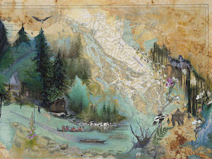
Autumn 2020Juan de Fuca painting by Melissa McCannaJuan de Fuca painting by Melissa McCannaSummer 2020Going Home, painting by Julia MillerComing Home by Dawn Henthorn Salmon come home home to the Elwha. Bit by bit of rubble two feet at a time, the dams were removed,...
Salt Marshes
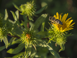
by Ron Hirschi, Autumn 2020Gumweed photo by John F. WilliamsGumweed photo by John F. Williamsby Ron Hirschi, Autumn 2020I’ve enjoyed, studied, mapped, and tried to protect wet places for pretty much my entire life. So, I thought I’d take the opportunity to share some...
Importance of Wetlands
by Josh Wozniak, Autumn 2020 Photographs by John F. Williamsby Josh Wozniak, Summer 2020 Photographs by John F. WilliamsTaking many forms, wetlands are natural features of the landscape that provide crucial functions for both nature and humankind. We benefit directly...
Newts: Wetland Magicians
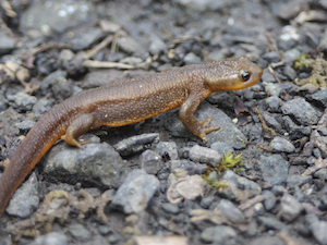
by Sharon & Paul Pegany, Autumn 2020 Photos by Sharon Pegany except as notedby Sharon & Paul Pegany, Summer 2020 Photos by Sharon Pegany, except as noted. Did I just see what I think I saw? I had to do a double take while exploring the edge of a local pond...
Healthy Wetlands
by Curt Hart and Marcus Humberg, Autumn 2020Wetland at Point No Point, photo by John F. WilliamsWetland at Point No Point, photo by John F. Williamsby Curt Hart and Marcus Humberg, Summer 2020For the 4.2 million residents in and around Puget Sound, there is a good...
10 Things About Duckweed
by Adelia Ritchie, Autumn 2020 Photos by John F. Williams, except as notedby Adelia Ritchie, Summer 2020 Photos by John F. Williams, except as noted 1. Duckweed grows in dense colonies in quiet water that is undisturbed by wave action. We try to avoid insulting still...
Carpenter Creek Salt Marsh
by Melissa Fleming & Terry Pereida, Autumn 2020 Photos by Terry Pereida, except as notedSalt marsh with the main channel running down the middle. Photo by Tom TwiggSalt marsh with the main channel running down the middle. Photo by Tom Twiggby Melissa Fleming &...
Wetland Basics
Frank Stricklin, Autumn 2020 Photos by John F. Williams except as notedThis large wetland in Newberry Hill Heritage Park is listed by the State of Washington as a “wetland of significant conservation value.” It contains many species of aquatic plants, and some...
Blue Carbon
by Adelia Ritchie, Autumn 2020Underwater Rainbow, painting by Julia MillerUnderwater Rainbow, painting by Julia Millerby Adelia Ritchie, Summer 2020As you’ll see everywhere else in this issue, a wetland system isn’t just another lovely place for a nature walk. Wetland...
COPYRIGHT
Copyright SEA-Media
All rights reserved. Reproduction or distribution, in whole or in part. without consent of copyright owner is strictly prohibited — except for brief quotations in critical reviews and other noncommercial uses permitted by copyright laws.
SEA-Media is a 501(c)(3) nonprofit corporation
PLEASE HELP SUPPORT
SALISH MAGAZINE
DONATE
Salish Magazine contains no advertising and is free. Your donation is one big way you can help us inspire people with stories about things that they can see outdoors in our Salish Sea region.
We also don't advertise Salish Magazine, so please spread the word of this online resource to your friends and colleagues.
Thanks so much for your interest and your support.