WHIDBEY ISLAND KETTLES
by Sadie Bailey, Spring 2021
Photos & video by Tom Noland except as noted

WHIDBEY ISLAND KETTLES
by Sadie Bailey, Spring 2021
Photos & video by Tom Noland except as noted
I have always loved cloudy days. The kind of days where the grey takes over the color of the world. Where the rain is held by the clouds’ fingertips and is forced to stay inside until more clouds arrive. That was the kind of day that I chose to go discover a piece of nature’s beauty, the Kettle Trail System on Whidbey Island.

Photo courtesy of Washington State Department of Natural Resources
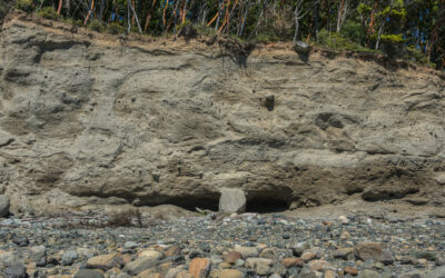
The name of the Kettle Trail System reflects the island’s past glacial history. From about 18,000 to 14,000 years ago, Whidbey Island was covered in ice up to 4,000 feet thick. When the glaciers melted, they left behind thick layers of sand, gravel, boulders, and clay over the underlying island bedrock.
With this glacial history, today we can see formations such as kettles and kettle lakes. Kettles, also called “kettle holes” in geology, can be defined as a depression in the land made by the melting of a detached mass of buried glacial ice. Some kettles are filled with water year-round and are called “kettle lakes.” Others hold water only part of the year.

Map courtesy of Washington State Parks, click it to see a larger version. Information about the park can be found at parks.state.wa.us/507/Fort-Ebey
Many of Whidbey Island’s kettles, along with other glacial features such as drumlins and moraines, have been overgrown in dense forests and are hard to see. However, Lake Pondilla is a readily accessible kettle lake located in the northwest corner of Fort Ebey State Park, a short walk from a parking lot and picnic area.
There are thousands of kettle holes, lakes, and formations in the United States. The Kettle Trail System on Whidbey Island is one place to find some, but also places like Iowa, Massachusetts, and Michigan have them. In Iowa, Clear Lake is considered a kettle; in Massachusetts, Cliff Pond is one; and in Michigan, Heart Lake is considered a kettle. Of course, there are many named kettle lakes in those states, as well as other places. Knowing that there are so many lakes and kettle formations throughout this nation shows just how impactful the Ice Age was.
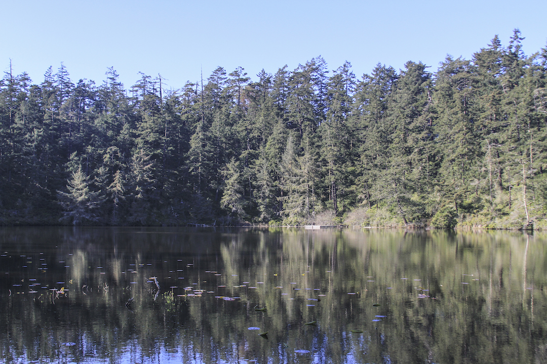
Looking across Lake Pondilla, a kettle lake on Whidbey Island. Dense forest surrounds the lake today.
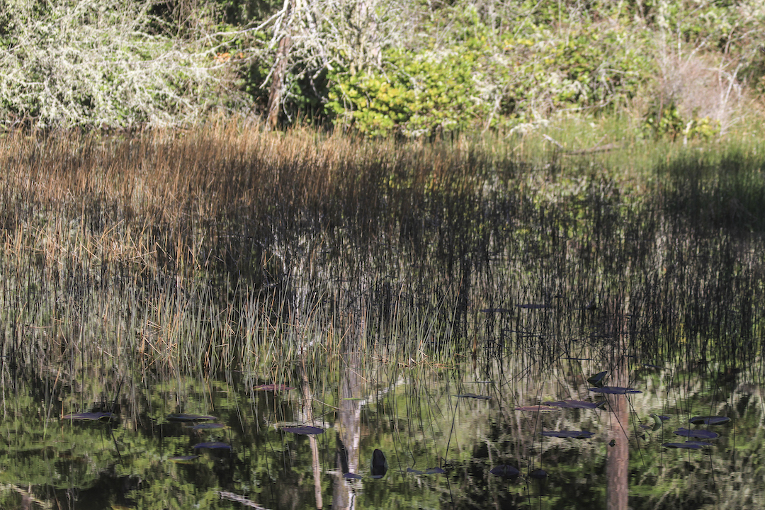
The southern part of Lake Pondilla transitions into a special kind of wetland called a fen. Here the edge of the fen supports a bed of rushes.
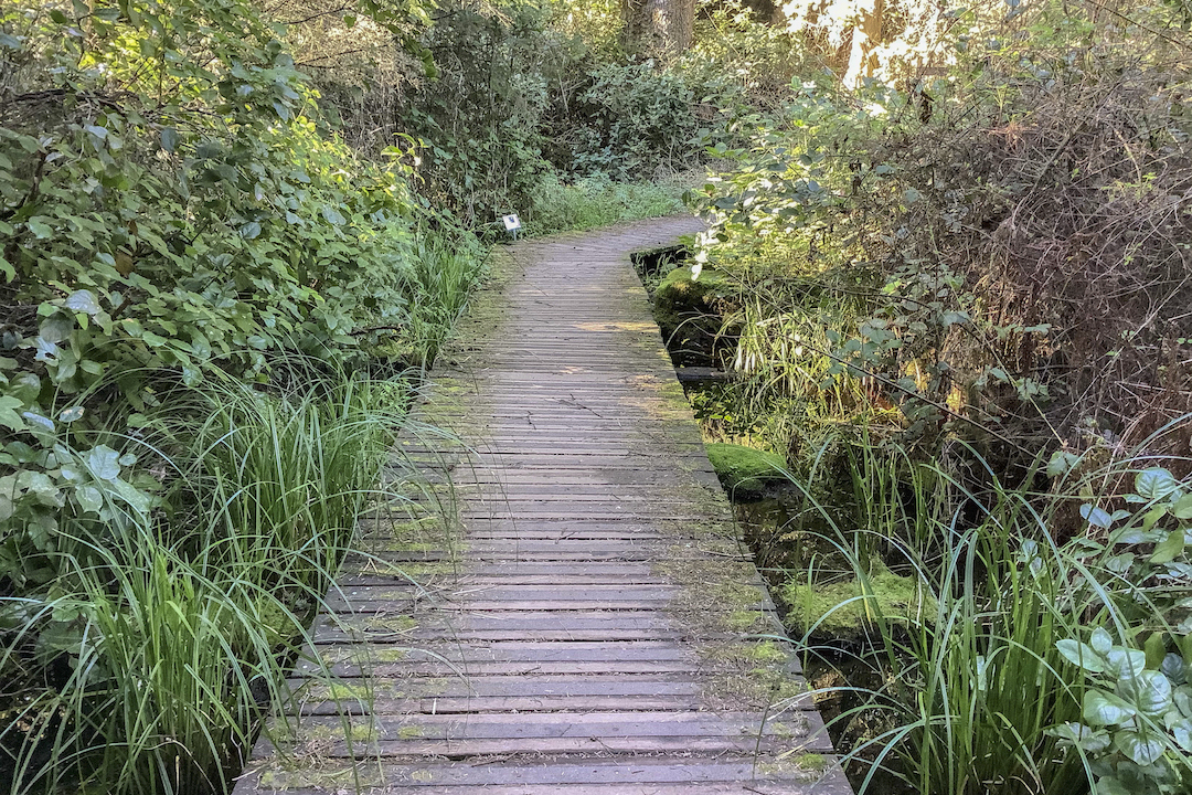
A boardwalk crosses the southern part of the fen wetland, connecting to a short nature trail along the east side of Lake Pondilla. Please be aware that the northeast part of the lake is privately owned (outside the park).
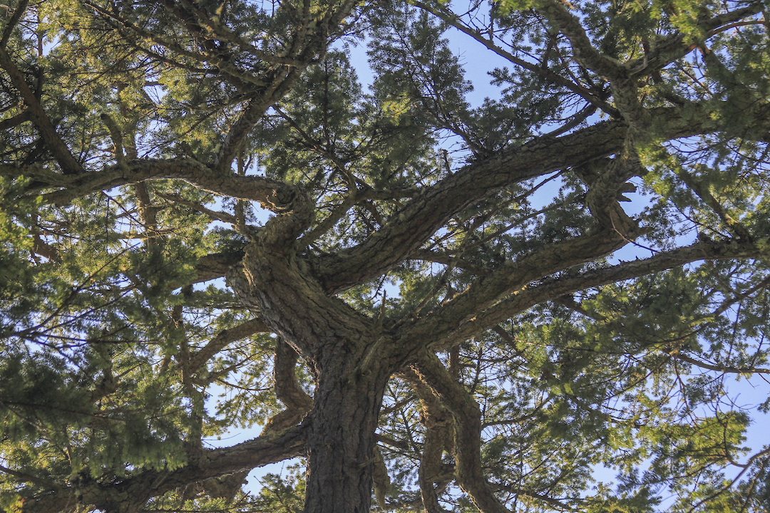
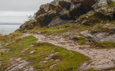
Large old Douglas fir trees cover the steep slopes around Lake Pondilla, along with cedar and spruce. Hiking the trail around the lake, some amazing views are in the tree canopy above your head.
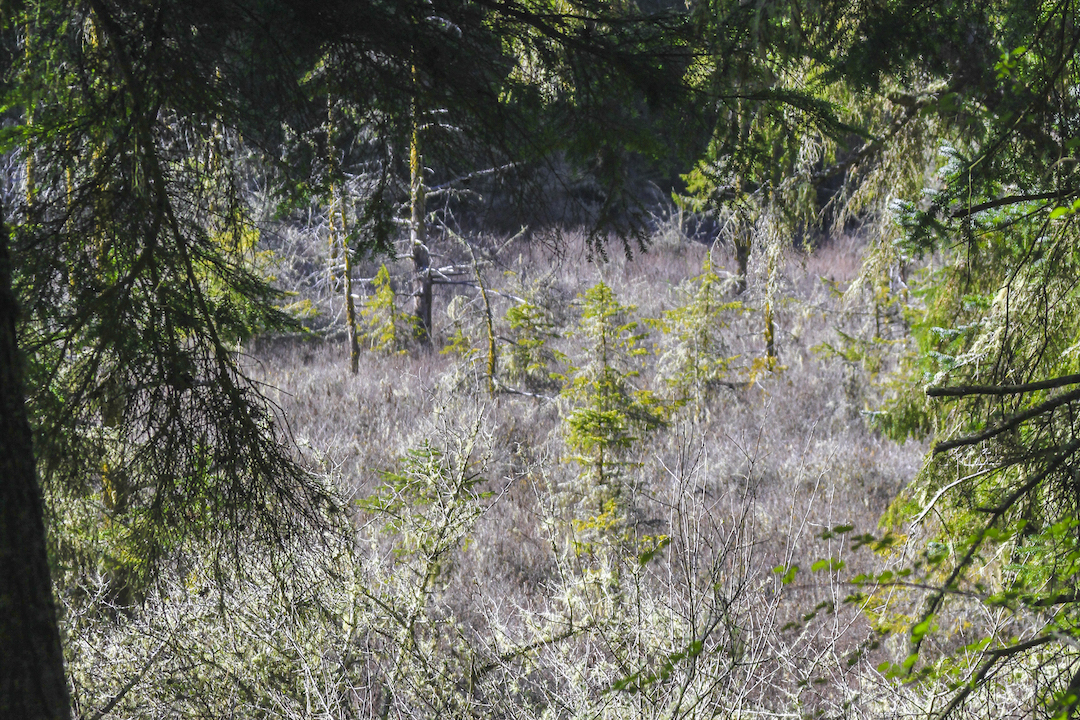
A dirt trail allows visitors to walk around the edge of Lake Pondilla and peer into the fen wetland. Stunted conifer trees can be seen growing up through a fairyland of lichen-crusted shrubs.
On Whidbey Island I peered across the kettle lake, taking in the scenery, hoping to remember every detail. The water was smooth, as if someone had run a knife over it to clear the ripples. Mossy trees covered the edge of the circular formation. In the bushes where I was standing, I could still see the whole kettle, and noticed there was no beach. Birds that chirped around me, and the clouds stayed put as a curtain of the sky. These were the little details of an ecosystem that this kettle had created.
The open water of Lake Pondilla supports a community of floating native pond lilies that can be seen from shore. Another part of this kettle lake has filled with vegetation over the years, creating a fen. A fen is a type of wetland that has peat soils and is fed by groundwater.
Sometimes the small palette of colors in the forest makes it difficult for photographs to convey the visual impact. But video can help overcome that limitation.
Since there is so much happening around kettle formations, they become an important part of the environment. Experiencing these formations now is important. With human society pushing aside many aspects of nature, it is important to take observations, breathe in the moment, and live gracefully in the cloudy days.

Sadie Bailey is a volunteer writer for Salish Magazine. Exploring and writing have always been hobbies that are important in her life. While enrolled in Olympic College, Sadie plans to transfer to a university, expanding her associate degree. Even with busy days of a full school schedule, writing, exploring, and volunteering are major priorities in her life.
FIND OUT MORE
The Kettle Trail System on Whidbey Island has miles of winding dirt paths within Fort Ebey State Park and adjacent county land, providing access to forest, bluffs, and beaches. It’s a good idea to download a trail map before you go. The trails are hilly and can be muddy during the rainy season.
This central part of Whidbey Island is encompassed in the Ebey’s Landing National Historical Preserve, the first historical preserve in the nation designated by the National Park Service in 1978. A map of trails and other features is available from the National Park Service.
Table of Contents, Issue #11, Spring 2021
Huge Ice Flood
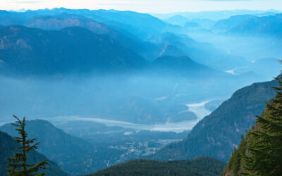
by JOHN J. CLAGUE and NICHOLAS J. ROBERTS, Spring 2021The longest river in British Columbia twists through the Fraser Canyon and past the town of Hope. Photo by Michael A. Thornquist, Seaside Signs.The longest river in British Columbia twists through the Fraser Canyon...
WA Megafauna
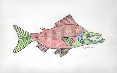
by Thomas Noland, Spring 2021 Photos by Thomas Noland at the Burke Museum in Seattleby Thomas Noland, Spring 2021 Photos by Thomas Noland at the Burke Museum in SeattleWe’ve been lucky to find remnants of really big creatures from the past here in Washington. Not...
Poetry-11
Spring 2021 Photos by John F. WilliamsSpring 2021 Photos by John F. WilliamsShe feels the heat by Janet Knox From deep below groundDegrees add degrees the deeperHeat of exhaust bodies degassingIn cars like coffins the heat of ageDone with pregnant possibilityHer body...
Our Icy Past
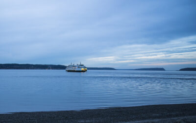
by Nancy Sefton, Spring 2021 Photos by John F. Williamsby Nancy Sefton, Spring 2021 Photos by John F. WilliamsFerries are an integral part of today’s Salish Sea region. But thousands of years ago, you could have simply walked across the Salish Sea, that is, if you...
Riches of the Prairies
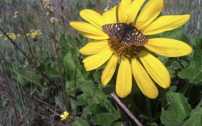
by Sarah Hamman, Spring 2021Taylor's checkerspot butterfly visiting a balsamroot flower. Photo by Sarah Hamman.by Sarah Hamman, Spring 2021The geologic history of the Puget Lowlands is filled with drama — multiple glacial advances, glacial outburst floods, tectonic...
Language of Glaciers
by Chrys Bertolotto, Spring 2021 Photo by Tom Nolandby Chrys Bertolotto, Spring 2021 Photo by Tom NolandGlaciers are such immensely powerful rivers of ice that they shape landscapes in their path. They have done this to such a degree that new words needed to be...

Videos-11
Spring 2021 Photo by Cookie the Pom on UnsplashSpring 2021 Photo by Cookie the Pom on UnsplashYes, that's Videos-11, not Oceans Eleven. These are some videos that illustrate some of the ideas discussed in the articles and poems in Salish Magazine issue number 11....
COPYRIGHT
Copyright SEA-Media
All rights reserved. Reproduction or distribution, in whole or in part. without consent of copyright owner is strictly prohibited — except for brief quotations in critical reviews and other noncommercial uses permitted by copyright laws.
SEA-Media is a 501(c)(3) nonprofit corporation
PLEASE HELP SUPPORT
SALISH MAGAZINE
DONATE
Salish Magazine contains no advertising and is free. Your donation is one big way you can help us inspire people with stories about things that they can see outdoors in our Salish Sea region.
We also don't advertise Salish Magazine, so please spread the word of this online resource to your friends and colleagues.
Thanks so much for your interest and your support.